


BackCountry Navigator XE
Topo
توضیحات BackCountry Navigator XE: Topo
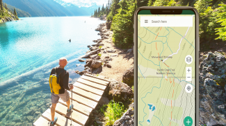
برای کاوش در فضای باز با استفاده از گوشی هوشمند خود، نقشه های توپو را به صورت آفلاین بارگیری و استفاده کنید! از GPS موجود در گوشی هوشمند خود برای پیمایش، علامت گذاری مسیر و ثبت نقاط بین راه استفاده کنید.
به مزایایی که BackCountry Navigator XE در جدول آورده است نگاه کنید.
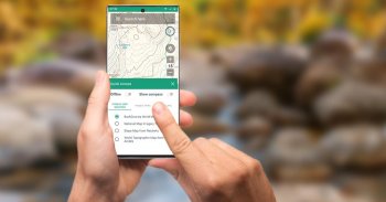
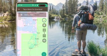
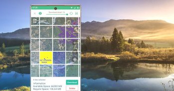
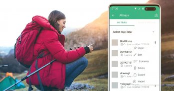
دانلود آسان نقشهها مبتنی بر شبکه
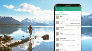
می توانید روش ساده تری را برای بارگیری و سازماندهی نقشه های آفلاین، انتخاب مربع های بزرگ در یک زمان امتحان کنید. آنچه را که دارید و نیاز دارید تجسم کنید.
ما انواع مختلفی از نقشههای خاص در سراسر جهان و کشور داریم که میتوان آنها را برای استفاده آفلاین بر اساس عضویت سالانه بارگیری کرد.
عضویت برنزی برای استفاده از اکثر نقشه ها.
عضویت نقرهای برای استفاده از نقشههای شیبدار سایهدار ایالات متحده، بهعلاوه نقشههای خدمات جنگلی ایالات متحده.
عضویت طلایی برای استفاده از نقشههای Accuterra، با نقشههای جدید و قابل خواندن از ایالات متحده و جهان، بهعلاوه BackRoads MapBook Basemap در کانادا.
بردار نقشه های توپو برای جهان
نقشه پیشفرض، نقشه BackCountry World، مجموعهای از نقشههای توپو برداری برای جهان است. نقشههای کاشیشده برداری نوید جزئیات چندسطحی واضح را با قابلیت دانلود تکههای بزرگ از سطح زمین در یک عملیات سریع و فشرده دارند. نقشه توپو BackCountry برای جهان را می توان در این برنامه و در
bcnavxe.com
مشاهده کرد، با یک فرآیند آسان برای نصب آنها در بلوک های بزرگ.
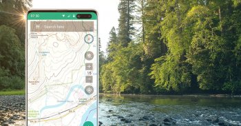
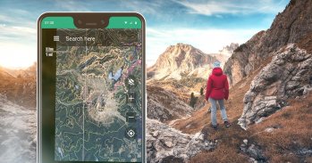
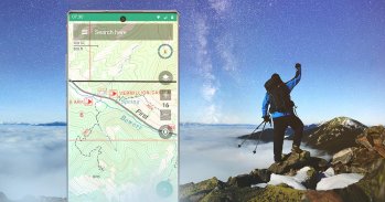
پیمایش GPS
با استفاده از GPS در تلفن هوشمند امروزی، موقعیت خود را روی یک نقشه آفلاین متحرک ببینید. راه خود را به نقاطی که روی نقشه علامت گذاری کرده اید یا از وارد کردن مختصات در نوار جستجو ایجاد می کنید، بیابید.
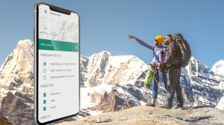
برنامه ریزی در ابر
وب سایت
bcnavxe.com
رابط وب BackCountry Navigator XE است. با استفاده از آن می توانید نقاط، مسیرها و مرزهای سفر را ترسیم کنید و آنها را در صورت تقاضا در اپلیکیشن موبایل دانلود کنید. میتوانید سفرهای ایجاد شده در برنامه تلفن همراه را نیز برای بررسی یا اشتراکگذاری به فضای ابری فشار دهید.
Cross-Platform
BackCountry Navigator XE روی Android کار می کند، یک برنامه جدیدتر در iOS و یک برنامه وب برای کمک به برنامه ریزی در
bcnavxe.com
دارد.
برنامه iOS از طریق
Appstore
در دسترس است
ما به خاطر محصول قبلی
BackCountry Navigator PRO
شناخته شدهایم که هنوز پشتیبانی و توسعه در یک مسیر موازی.
https://play.google.com/store/apps/details?id=com.crittermap.backcountrynavigator.license
برای اینکه ببینید چرا ممکن است بخواهید از PRO به XE ارتقا دهید، این
مقایسه
را ببینید.
همچنین میتوانید در فهرست XE مشترک شوید تا از وضعیت، بهروزرسانیها و معاملات مطلع شوید.
BackCountry Navigator XE: Topo - نسخه 3.1.8
(19-11-2024)BackCountry Navigator XE: Topo - اطلاعات APK
نسخه APK: 3.1.8حزمة: com.crittermap.backcountrynavigator.xeآخرین نسخه BackCountry Navigator XE: Topo
سایر نسخهها


اپلیکیشنها در دسته مشابه


